Geospatial ISR: Incredible Imagery Collection And Processing Power
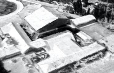
The Performance-enhanced Airborne Reconnaissance Low (PeARL®) camera system is a suite of electro-optical sensors with flexible configurations. PeARL® provides sharp, precise, high-resolution aerial imagery in support of mission requirements.
The PeARL® collection systems have been employed by the U.S. Special Operations Command (SOCOM) on both manned and unmanned platforms in the most challenging combat environments since 2003. PeARL® systems are currently fielded in support of U.S. operations in the Middle East and South America.
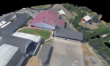
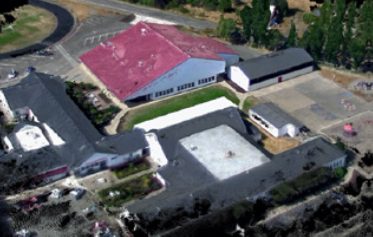
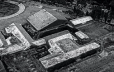
PeARL® Flash provides rapid 2D and 3D processing of any airborne imagery into industry-standard outputs for mission planning, area familiarization, and GEOINT exploitation. 3D On Board (3DOB) is a fully automated FMV to image processing solution that generates 3D models from within minutes of collection.
Explore our extensive suite of PeARL solutions:
PeARL® 7
Customized Sensor Technology For Actionable Intelligence
With PeARL®, sensing is seeing. When your mission requires the fastest, most accurate information, your mission requires PeARL®. PeARL® sensor systems provide fast, customizable solutions that enable operators to obtain high-resolution imagery over a wider area, making it the most efficient solution on the market. With over 30,000 flight hours, PeARL® is the sensor system of choice for maximizing your time in the air to ensure mission success. The PeARL® collection systems have been employed by the U.S. Special Operations Command (SOCOM) on both manned and unmanned platforms in the most challenging combat environments since 2003.
Operationally Proven And Ready
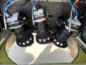
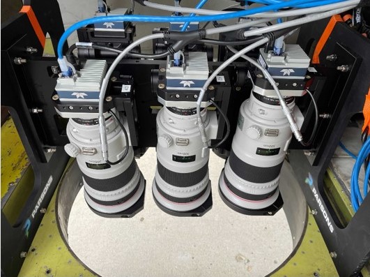
Building on our field-proven expertise, the seventh-generation sensor system, PeARL®7, provides fast deployment using plug-and-play sensors to fit any mission. PeARL® 7’s proven commercial off-the-shelf (COTS) sensors provide the fastest mission-ready solution. With built-in flexibility that allows for rapid customization to meet requirements, PeARL®7 can be bought as-is to serve nearly all uses and customized to fit any aircraft, allowing for two to six sensor configurations, along with the ability to collect imagery from 1,000 feet to over 15,000 feet and accommodate pitch angles for 2D or 3D collections.
2D And 3D Optimizations
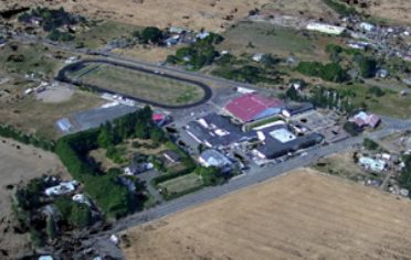
In 2D optimized mode, PeARL 7 has a large field of view and incredible imagery resolution, which reduces the number of needed collection passes, flying time, and costs. This 2D optimized capability can collect vast areas quickly to build temporally relevant maps and imagery products.
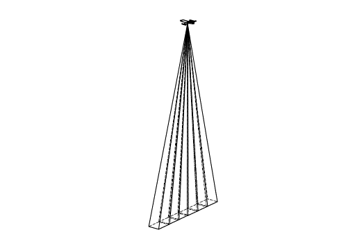
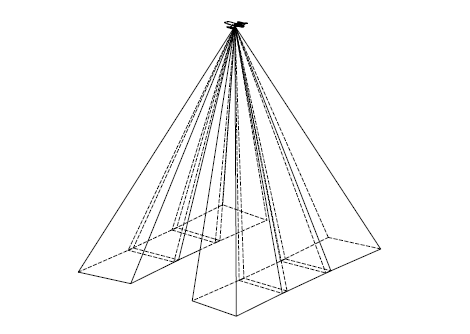
The 3D capable mode of PeARL 7 allows the user to rapidly generate accurate, timely 3D models, which are becoming increasingly more important for mission planning. PeARL 7 can collect data for 3D processing over area of interest in a single pass. This capability allows for covert collection, which lowers the probability of detection.
2D Optimized
- Four to six 45MP sensors generating 180 to 270 MP per exposure
- Ideal for medium-to-high altitude wide-area mapping and point target capable
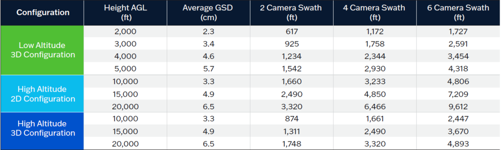
- High altitude/large aircraft: spatial resolution of 5 centimeters at 15,000 feet AGL (above ground level) with a 7,200-foot-wide collection swath
- Premier EO array used by the US DoD and intelligence community since 2004
3D Capable
- Two to six 45-MP sensors providing 90 to 270 aggregate MP per trigger
- Designed for single-pass 3D data extraction and modeling
- Low altitude/small aircraft: spatial resolution of 3.4 centimeters at 3,000 feet AGL with a 2,591-foot-wide collection swath
- Two off-NADIR arrays optimal for urban environments (oblique mapping)
- Currently used for commercial/civilian mapping applications
PeARL® Flash
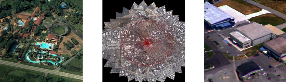
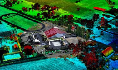
PeARL® Flash provides on-demand 2D/3D processing of sensor agnostic geospatial data that is scalable to a customer’s in-house, virtual, or cloud-based data processing environments. PeARL® Flash processes FMV, WAMI, small drone imagery, and frame imagery, including PeARL®.
High-Resolution Aerial Imagery
The photogrammetry and computer-vision approach enables a true representation of the collected space. PeARL® Flash includes:
- Dense 3D extraction
- Seamless product export to Google Earth™, NASA WorldWind, ESRI, and FalconView
- Georeferencing
- Orthorectification
- 3D modeling
- Seamless mosaicking and blending
- Support standard outputs for Augmented/Virtual Reality and gaming exploitation systems
3D On-Board
3DOB, powered by PeARL™ Flash, is a near real-time 2D and 3D image processing solution that generates 3D models from FMV within minutes of collection. 3DOB can be installed on-board the platform, at the Ground Control Station (GCS), or at edge compute facilities. This fully automated appliance delivers geospatial products to the end-user in standard formats in bandwidth limited environments, removing the need for rear-echelon and CONUS processing.
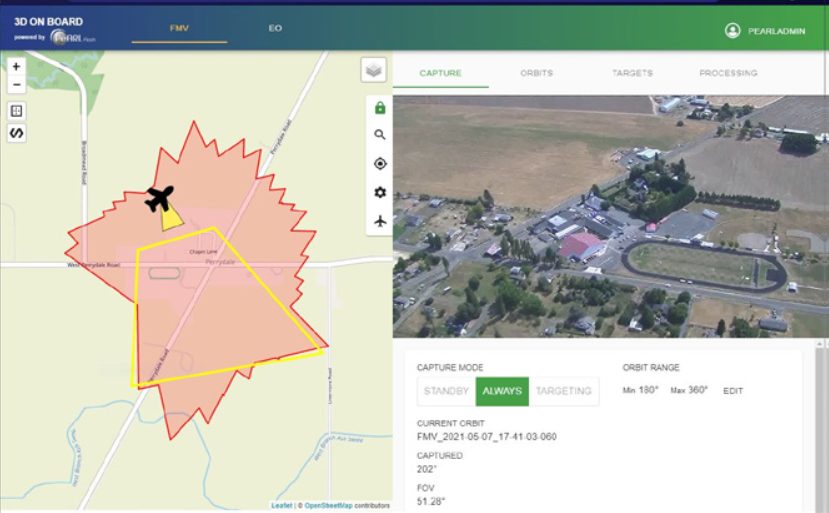
Onboard Processing
- Uses Native/Organic FMV sensors – no additional sensor hardware or changes to how data are collected
- Supports EO, EO-IR, SWIR, MWIR, and LWIR, at all resolutions and zoom levels (Wide through Ultra-Narrow Field of View)
- Ingests all MISB compliant formats via standard internet protocols (TCP-IP/UDP)
Processing Hardware
- 1U server (on-board or at ground-station)
- GPU enabled algorithms
Products Optimized For CONOPS
- Single/Multi AOI-orbit approach with ability to cache and process multiple sites simultaneously
- FMV orbit processing optimized
- Linear, route and road mapping functionality
- Industry standard outputs open directly into GIS applications, Google Earth, and Virtual Reality systems.
*Parsons complies with all applicable Trade Compliance regulations. Some of Parsons products may require an authorization from the U.S. Government before they are exported.
For pricing information for any of our precise and high-resolution aerial imagery suite of products, please complete the contact us form.
Related Products
Mission Link Modem ↗
Mission Link Modem High Rate (MLM-HR) represents the next generation of integrated solutions for ground systems.
Signal Conversion Systems ↗
The icCON series of signal converters includes a variety of configurations to satisfy a wide range of signaling requirements.
C2Core® ↗
We provide multi-manifest flight systems and launch integration capabilities to operationalize access to space for small space systems.